Woke up just after 2am. Tried to go back to sleep for an hour but don't think I managed to. Finally got up at 2.55am. We were in the car and ready to go at 3.45am. Ann had gone to reception and picked up our Grab and Go breakfast bags which you can get if you aren't around for breakfast. Apparently the guy in the office was asleep when Ann went in and was startled by someone walking in at that time of the morning.
Got in the car and headed off into the darkness. We were heading for somewhere that I wasn't sure we would find. Phones and GPS would stop working at some point on our journey and where we were heading for wasn't particularly well marked. But being optimistic, that having studied Google maps, I could find it if we lost our technology I thought what the hell. Set the route on Apple play and hoped for the best.
Drove the first 38 miles pretty quickly as it was 65mph limit and fairly straight. No wildlife jumped out at us especially not the cows as signposted. The next twelve miles were first up a mountain and then down the other side on a winding road. Needless to say they were slower especially in the pitch black. Helpfully this meant we had no idea what was off the side of the road so pretended to myself there were no vertical drops without crash barriers.
The road levelled out and straightened again for another 8 or so miles back at 65mph. Apple maps still ok at this point. The next 19 miles were up a mountain again and then back down on winding roads. Unfortunately we ended up behind the only car up and about at this time and it wasn't going particular fast. However in the dark on winding roads with drops off the sides decided to just follow at a distance. This did mean Apple maps thought our arrival was going to be a few minutes later.
Eventually after a painful drive we got back on levelish ground and then we got to turn off the main route away from the slow car. The next 12 miles were fairly good and we just played a game of look for the sign. Apple music had stopped working a long time ago without a signal however the GPS was still going.
Eventually we saw the sign which was where it should be and we turned off the road onto a gravel track. The time was now 5.20am. We had six miles to go up the track still in the dark. Put the car in 4WD and set off. The things I had read online about this track varied from you can't get up it with anything wide, its really bad, steep in places, rocky outcrops, you can only make it in a 4x4 to a person saying I saw someone drive a Prius up it and they were fine. It turned out to be fine apart from Desert Cottontails, a Kit Fox and a Black-tailed Jack Rabbit trying to get run over. There was one short steep lump and then a tight turn right at the top with nothing to stop you falling off the side. Eventually arrived at our destination at 5.40am.
We'd made the decision to go there last night. We had a choice of Zabriskie Point or Aguereberry Point to see the sunrise over Death Valley. Zabriskie is where everybody, including the National Park Service, suggest going to watch. It is on the eastern side, is accessible by tarmac road and has a big carpark, however it is apparently very busy and unless you get there early you cannot get a parking space. It also faces away from the sun, so you don't actually watch it rise but you can see it light up the western side of the valley.
Aguereberry Point is on the western side so you can see the sun rise over the eastern mountains, it is much quieter, however, it is up the 6 mile gravel track and you won't necessarily see the same colours in the rock as you are looking towards the sun. We found a couple of people online saying it is actually the best place to go. We were unsure and debated for a while but eventually decided to do what we normally do which is to not follow the crowd.
Having arrived at Aguereberry Point which is 1.2miles above sea level we put on our walking boots and jumpers and headed around the rocky outcrop to overlook Death Valley. Bizarrely at this point my phone buzzed and I'd received a Whatsapp message from Sarah Morley (I'll name drop you seeing as your message said you had been reading these long and winding blogs!) Replied and then for I think only the second time in my life I went live on Facebook for at least fifteen seconds as we waited for 6.03am.
I had walked all the way to the point but Ann had stopped short and said she was happy there. I messaged her and told her the view was great from where I was and then I went and dragged her down to the end. By now we were a couple of minutes away. Then this happened


Eventually having enjoyed the view long after the sun appeared we walked back to the car.
 |
| Empty car park |

Wondered if what we were feeling mirrored that of what those who first set foot here thought. Changed our footwear and got back in the car. The rising sun had already brought the temperature up a few notches.
Started the drive back down the track.
As we were nearing the bottom there was a turn off up another track towards this.
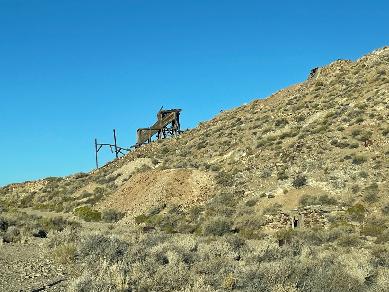
Drove the few hundred yards up it. Ann refused to get out the car so I went exploring.


When I got back in the car I was accused of having gone into the mine. I would have liked to but I was wearing flip flops. The sign stated this was Eureka Mine and it was eventually owned by Mr Aguereberry, he whom the point is named after. It says you can go into the mine but as a precaution to take two torches in case one fails. That is the only precaution you need if you decide to explore an abandoned gold mine.
We then carried on back to the tarmac and then drove the hour around to the National Park Visitor Centre at Furnace Creek. Arrived there just after 8am. It felt like about midday.
 |
| 8.10am |
Paid our entrance fee (there are no booths on the roads in) and then was asked by the ranger if we were going to any other parks. Said we would be going to Sequoia. She asked about Yosemite and we said we had already been. She asked me if I had the receipt for it, I searched my wallet but didn't have it. She said if you find it, when you get to Sequoia give it and the Death Valley one to them and then make them give us an Annual Pass to the National Parks. This costs $80 but the entry fees to both Yosemite and Death Valley would be deducted. It would save us $20.
Went off to stick the parking pass in the car. Whilst doing it I found the Yosemite receipt. Went back in and became US National Park members. Now we get into Sequoia for free!

Whilst I was becoming member, a couple were asking a ranger about which hikes are there to do in the valley. The ranger said none, don't hike. They said just a small one. The ranger said no, don't hike. There is a big sign at the front of the centre saying do not hike after 10am. Thought are people just idiots. All the information says do not stray away from your car. and do not drive off road as you main source of safety in the park will be passers by seeing you stranded. Another ranger put up the forecast for the day on the noticeboard and complained as it wasn't even going to get to 110 degrees today.
Looked around the centre and bought a magnet. Ate some food in the car and had a drink as there is no café in the centre. Then drove 18 miles south to Badwater, the lowest place in the western hemisphere. Walked on the salt flats. It was very hot. Did not stay very long, was now over 100. |
| The little white sign at the top is sea level |
 |
| 282 feet/85.5m below sea level |
 |
| The water |
 |
| Salt flats |
 |
| Not near the edge of the valley |